On this page I try to elucidate two theories:
1. That the names of the two quarries (Jackdaw and Kingham) were confused/transposed, and,
2. (Less convincingly) that the inclined plane may have been to the east of the Bluebell steps, and that the bottom railway may have gone to the west of Smith’s house.
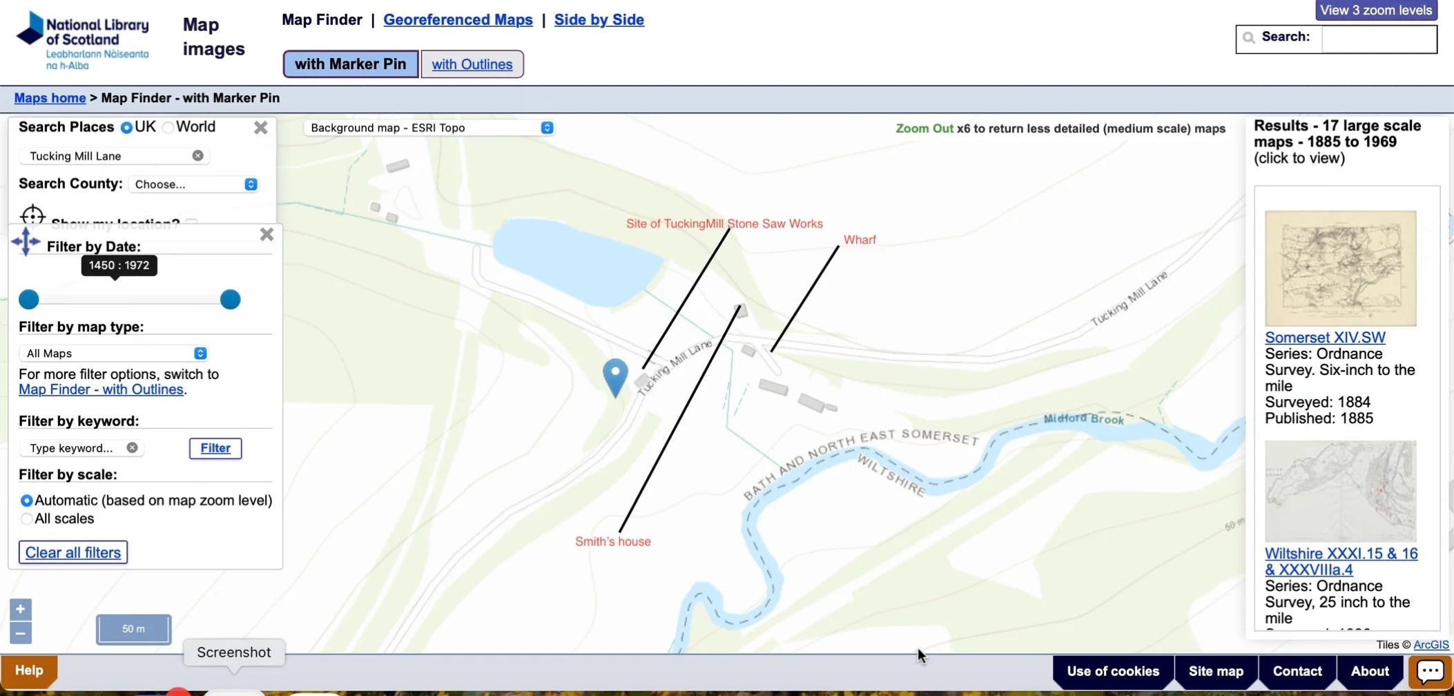
(Below) The area around TuckingMill, showing the lake/reservoir for the water-powered stone works
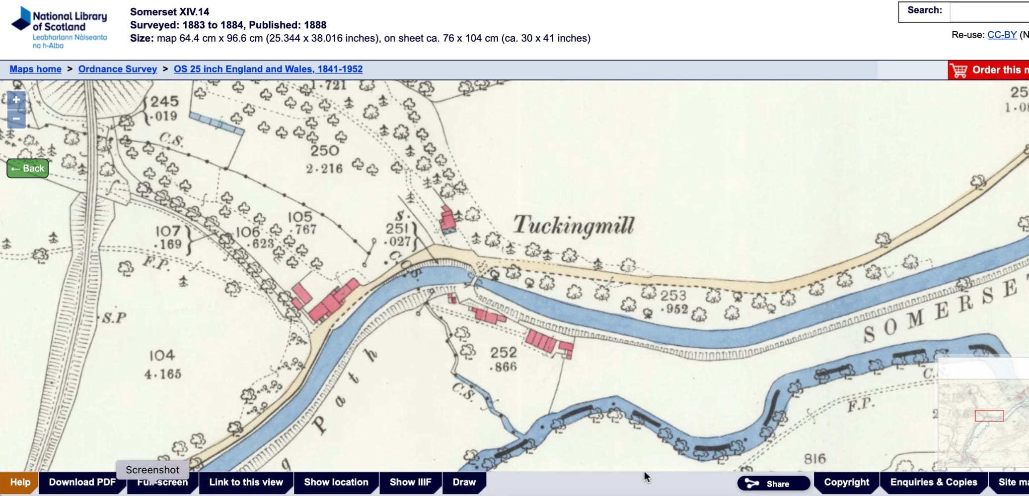
On this coloured 1883 map notice the double dotted lines run to the LEFT of Smith’s house. The wharf (above) seems to have disappeared
(“CS” in these OS maps means “Centre of Stream”.). OK, nothing really controversial so far , but now looks at this:
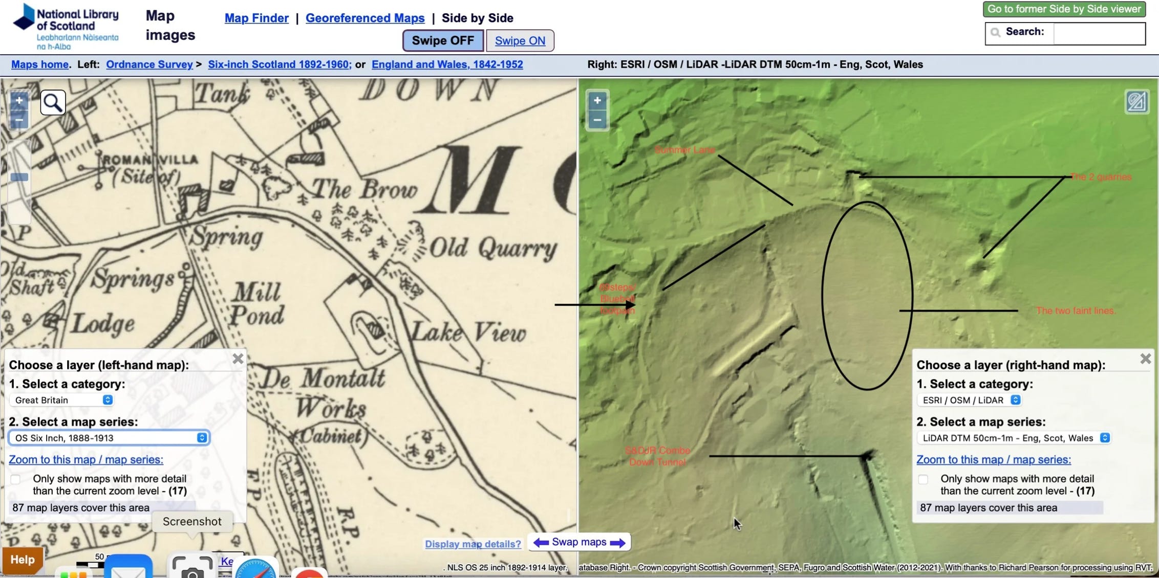
This is (on the right, above) a LIDAR scan of the quarry site . Where you can see ‘Old Quarry’ this is the recognised/supposed site of the Smith/Kingham Quarry as already outlined. However, to the left, (west), one can see another quarry site(to the left of ’T’ of “The Brow”).This has beencalled the Jackdaw Quarry. In fact a casual walk (Sept 2023) reveals that the whole area between the two quarries (in Kingham woods), was, perhaps, one big quarrying area.
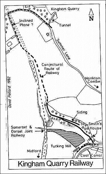
Just to remind you …this - to the left is/was the ‘official’ view. However, I offer three pieces of evidence to refute this. Now read this:
1. “Very little is known about this small undertaking and there is often confusion between this quarry and Kingham Quarry. Workman (2004) places Jackdaw Quarry on Summer Lane, approximately 200m east of Kingham Farm and nearly opposite Lake Cottage but the British Geological Survey locate Kingham Quarry at NGR 7644 6215, i.e. the approximate location of Jackdaw Quarry.
Workman describes the old blocked entrance as a well-preserved stone arch, approximately 3 metres wide by 1.5 metres high.
2. Furthermore… “there is evidence that William Smith worked the mine at site 21 (Jackdaw) for a time. Also his open quarry was probably on the hillside immediately above the entrance to this mine (there is still a quarry there, partly infilled), and not at site 20 nearer to Kingham Farm. (Information from Andrew Mathieson)”. (Journal of the Bath Geological Society, No. 23, 2004). See the map here for sites 20 and 21
3. And…Just beyond Kingham Farm (now Kingham Cottage) on the north side of Summer Lane, was the short-lived quarry opened by William Smith in about 1810 (20). This or a successor to it can still be seen in the wood by the road. There was also a mine known as Jackdaw (Jackday) (21) whose entrance was 200m east of Kingham Farm. The portal (blocked up) is still there, close to the road just beyond and opposite Lake Cottage. It is surprisingly large, the width being c.3m and exposed height c.1.5m. It has a well-preserved stone arch.(Ibid)
For a short paper (with a map) on the location of the stone quarries around Combe Down place see this link.
Notes: It is not known when the quarry was active. It has been suggested by Workman (2004) that stone from Jackdaw Quarry (and possibly Vineyard Down) was used to line some of the nearby Combe Down railway tunnel, which opened in 1874 and the quarry is shown on large scale OS maps as an 'Old Quarry' by 1904. The workings were rumoured to extend to Combe Down and pass under The Brow, as well as to connect to the nearby Vinegar/Vineyard Down Quarry”.
Source: https://www.mcra.org.uk/registry/sitedetails.php?id=1748
Also recall that Smith’s tramway may well have gone to the LEFT of his house, not right as shown on the diagram above.
So, is it possible that the names of the Jackdaw and Kingham quarries have been confused/transposed?
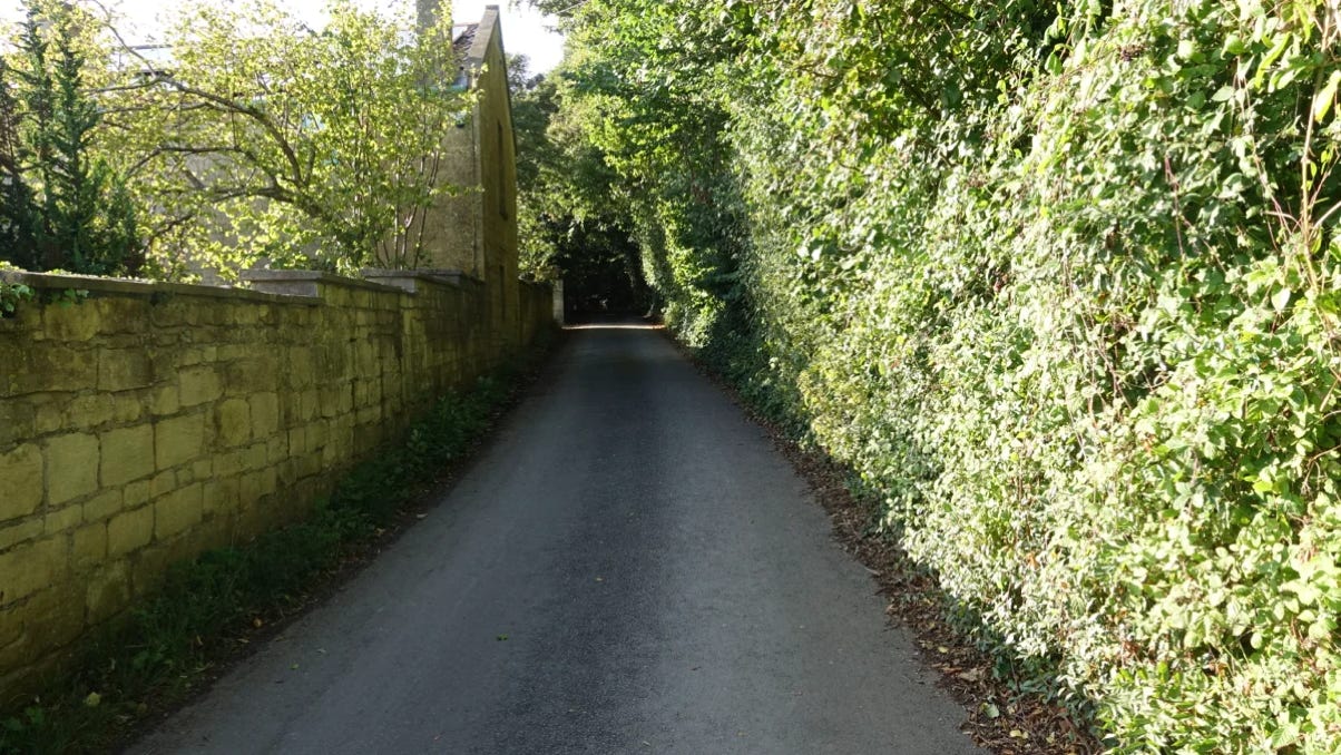
I believe this could be the case. The road for the ‘original’ (east) KinghamQuarry going westup Summer Lane to the right-angled bend to its descent down the valley, shows a gentle uphill incline. See opposite.(Therise is approx 1.65 meters).(The house “Lake View” is to the left). How did the stone get transported up this gentle incline?Horses presumably.
Instead I surmise that the west quarry was the Smith-owned one and that the stone would have been transported directly down the (very) steep hill. (See below). It would be interesting to know if this west quarry once had a stone arch entrance and a ‘fault’/gull inside. Remember that the rail/tramway would be serving three local quarries (Kingham, Vineyard Down and Jackdaw).
The LIDAR Map.
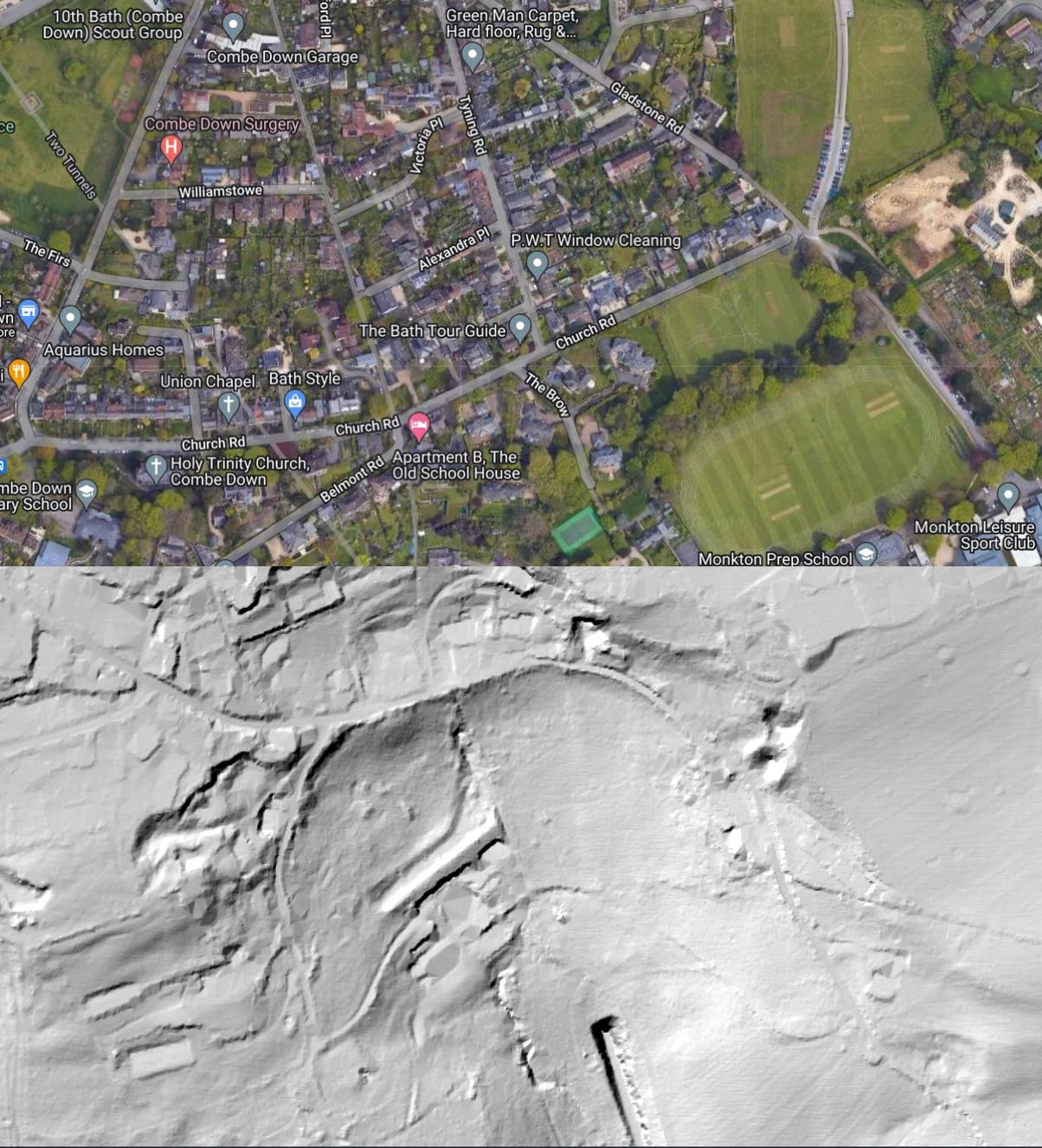
Revised GoogleMapsChart is here. (You may need to log into a Google account to view this -for some reason!)
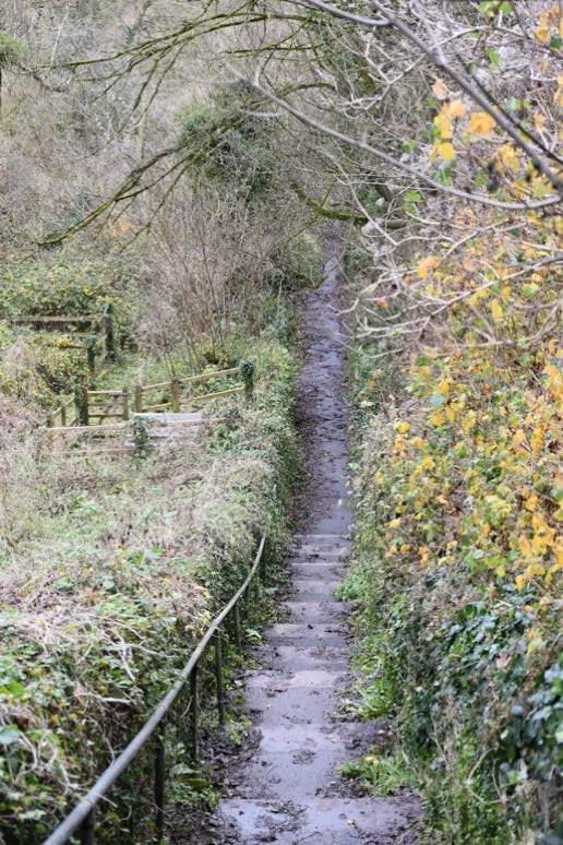
(Left) The “69 steps” (figures differ - some say ’66’!) from Summer Lane down towards the SCC wharf. This was thought to be the route of the rail/tramway - but I now have doubts!
On some maps called‘Bluebell Steps’.
Whether the quarry names were transposed or not does not preclude the possibility that the inclined plane was further to the east of the 69/BlueBell steps. (ie To the left of these steps )
Look again at another LIDAR map to the left. The two quarries can be clearly seen in the upper part of the scan. Look at the left quarry (Perhaps the Jackdaw quarry but I’m hypothesising that there is a possibility that this was Smith’s quarry). There are two faint, parallel, lines opposite this quarry running directly downhill until they disappear, not unreasonably, in the later cutting of the S&DJ Railway cutting as it exits Combe Down tunnel. One or both of these lines could be showing the site of the supposed inclined plane. (See previous LIDAR scan as well)
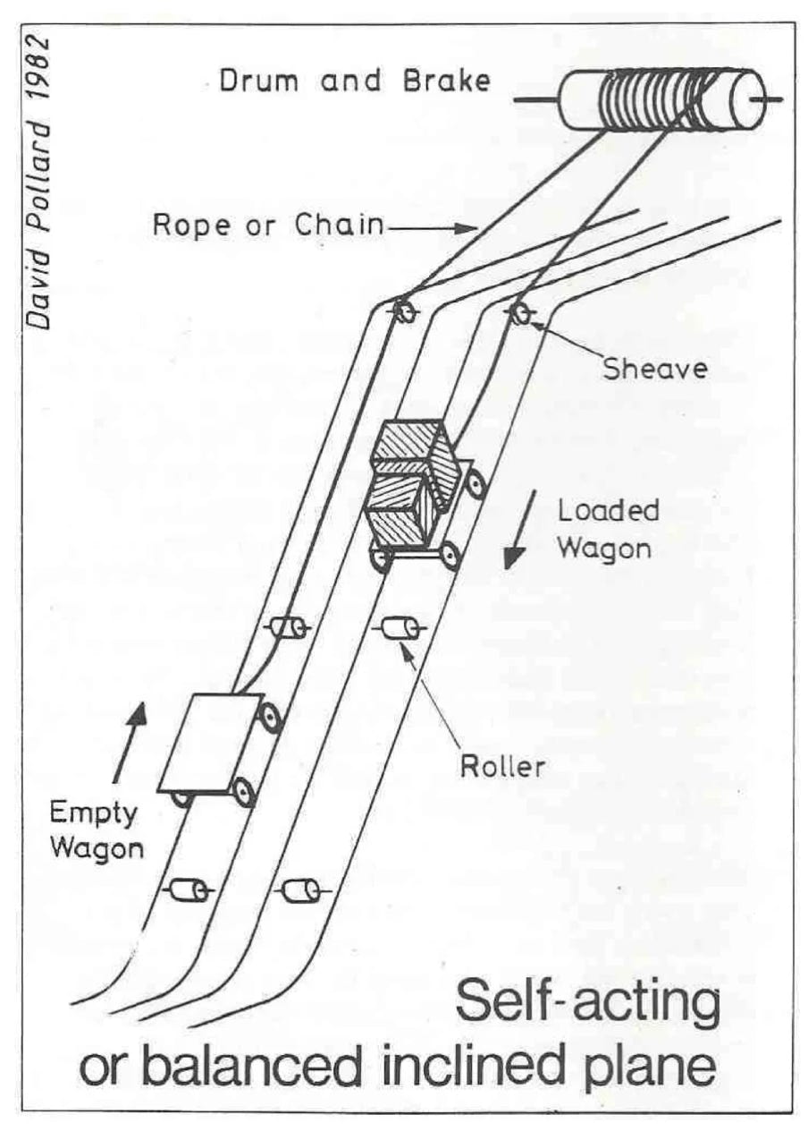
Perhaps the inclined plane looked something like this (below):
(https://b-i-a-s.org.uk/wp-content/uploads/2021/01/BIAS_Journal15_BATH_STONE_QUARRY.pdf).
It must be said, however, that there are other pale lines in others areas that could be LIDAR artefacts.
One thing that puzzles me a little is that the wharf on the SCC was directly opposite Smith’s house and railway (whether to the left or right of the house), which makes obvious sense until one realises that the stone would need to be carried a few hundred yards to the west to be dressed and sawn at the TuckingMill Works and transported back again to the wharf! How was this done? Horses? Boats? A railway extension? (NB curves were hard to make at this time and it would need a sharp bend here).
Sept 2023. I have applied to BIAS and the CombeDown Historical Society for permission to use their diagrams andinformation.
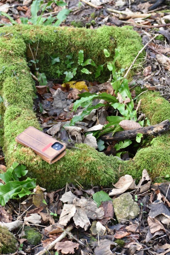
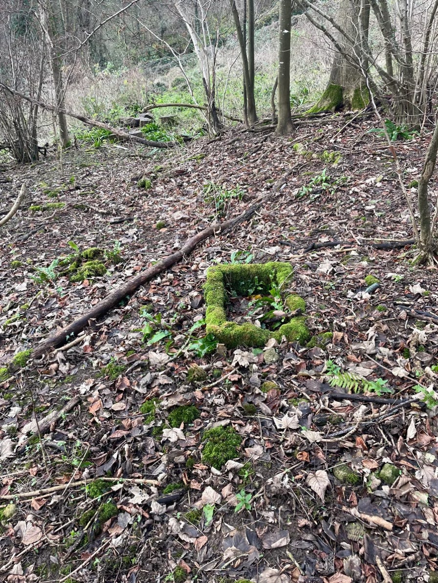
Update: Late December 2023. A stroll to the east of the BlueBell steps roughly in the area of the aforementioned two parallel lines on the LIDAR map found a line of small stones and other debrisrunning downhill to the field boundary. Photos don’t show it very well…BUT a few yards to the west of this line is what appears to be small stone trough -see below. (iPhone there for scale). It is tempting to wonder if this was the base for a roller - see the diagram to the right.Any other suggestions?