.The Somersetshire Coal Canal
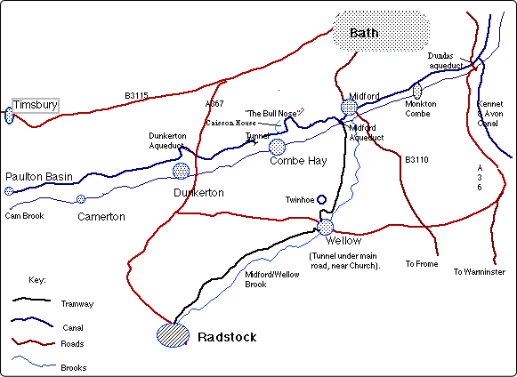
This map/picture (below)is also a hotlink to the SCC GoogleMap - just double click on it...The Timsbury Basin is on another exploded map- here.
Hint: Press the 'larger map' icon top right; then very bottom left, press the 'green map' icon.
For the ‘average’ tourist see: https://www.somersetcoalcanal.com
I am no longer the official webmaster. Please see the official sitehere.
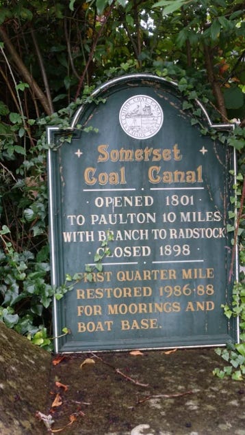
The Somersetshire Coal Canal (SCC) was authorised by an Act of Parliament in April 1794.
The canal was promoted by the mine owners of the North Somerset coalfields as a cheaper means of transporting their coal to the markets in Bath and the surrounding area. Surveyed by John Rennie (of Kennet & Avon Canal fame), with help from William Smith (1769-1839) - (the "Father of English Geology"); the canal was to have two arms, with connecting tramroads, to the many coal pits in the Radstock and Timsbury areas.(over 80 at one time).
An interesting feature of the canal was the varying methods used at Combe Hay to overcome height differences between the upper and lower reaches of the canal, initially by the use of Caisson locks and when this failed an inclined plane and then a flight of 22 locks.The canal was one of the most successful in the country, and in the 1820's was carrying over 100,000 tons of coal per year. However this prosperity was soon to be halted by the coming of the railways.
The opening of the railway line between Radstock and Frome started the decline in the canal's fortunes, by taking away the tramway's coal trade and eventually, in 1871, the tramway was sold to the Somerset and Dorset Railway who built their Bath to Evercreech line over much of its course. The Bristol and North Somerset Railway's Hallatrow to Camerton branch of 1881 further eroded the canal's trade on the Paulton arm.
With trade increasingly being taken by the railways and, the working out of the coal seams, combined with fall in trade from the Kennet & Avon (itself suffering from railway competition), it was not surprising when the canal company decided to close the canal. The official liquidator tried to sell the canal as a going concern in 1894 but to no avail, and the canal eventually closed in 1898. In 1904 the abandoned canal was sold to the Great Western Railway, who in 1907-10 built the Camerton to Limpley Stoke Railway over much of the northern, Paulton, ‘cut’.
The tunnel at Combe Hay was drained and used as a railway tunnel instead by the GWR mineral line
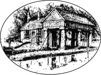
The Midford Weigh-House .
...The icon of the Trust's magazine .
For another 'photo of the Midford weigh housesee this link; ( 175kb file) - (This fine building is no longer standing).

Picture above: © Copyright Martin Bodman and licensed for reuse under this Creative Commons Licence.
The UK Canals Web-Ring
This site owned by
RTJ Stevens