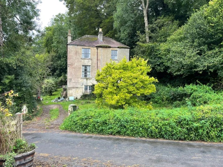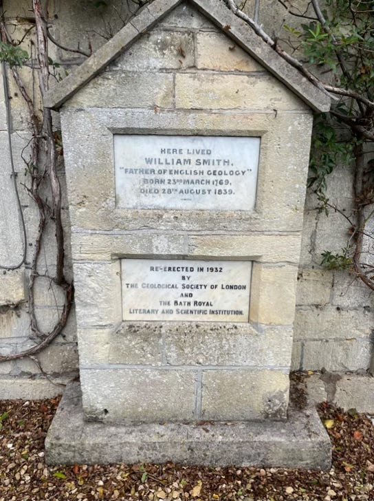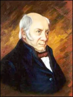
In 1798 William "Strata" Smith, (1796-1839) the "Father of English Geology” bought a small estate at Tucking Mill by the Somerset Coal Canal in the Valley below Combe Down. During 1809 or 1810, he conceived the idea of opening a Bath stonequarry at Kingham Field, on the edge of Combe Down, and conveying the stone by a railway down, to Tucking Mill where it would be sawn by machinery (a water-powered device?), and then loaded on to canal barges. Kingham Field was part of the Midford Castle estate of Charles Conolly.
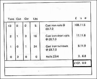
William Smith (in partnership it appears with his brother John), also built a lift bridge near his house, operated from the north side. Presumably built on stone with the bridge itself being made of wood. This may date from April 1802, with a replacement in situ approx March 1812 (costing £36). Entries in Smith's diaries show that planning started in the summer of 1810 and was well advanced by the 26 January 1811.Then he agreed to sell Tucking Mill Meadows to Conolly for £1 330, presumably to finance the scheme. On the 9 April 1811, his diary records: 'agreed with Mr Conolly for 0'Neal to begin his (Conolly's) part of the Railway'. Exactly a month later he wrote to Conolly: 'Iron rails must be ordered'. An inclined plane was undoubtedly necessary for part of the descent to Tucking Mill, and on 16 May 1811 Smith was 'at Bath, writing on . . . Rollers &c'. On 26 May 1811 he signed a 'conveyance and agreement for a lease of the Land & Stone & Railway'. Smith saw John Thomas of the Kennet and Avon Canal an 9 June 1811 and 'agreed with him for 32 tons Rails for Mr C and 13 for myself at £8.7.0.' The ranal (sic) Journal records this transaction in more detail:
Laying of the rails was in progress during August 1811, when Smith spent several days at Tucking Mill. On the 15th he 'ordered better spikes to be used in laying the rails'; on the 17th he 'went to Railway and advised about the laying &c'; on the 18th 'Mr Wm Hill called and talked over the-proposed sawing of stone by the power of my waterfall'. A second boatload of Iron Rails arrived an the 23rd. It is thought that some of the rail used was second-hand from the Caen Hill flight (on the Kennet & Avon Canal). One wonders if the railway was started at the bottom of the valley towards Summer Lane.
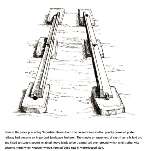
The railway itself comprised two lines of rough-hewn stone sleeper blocks, each stone up to about one-footsquare (30cm2), placed so that three-foot (91cm) lengths of rail could be laid between the sleepers, and fastened with nails hammered at each end of the rail into wooden plugs inserted into holes drilled into the stones. One nail was sufficient to secure two adjoining rails, or ‘plates’. The plate-rails themselves were cast-iron and had an L-shaped cross-section. (See opposite : https://combedownheritagesociety.files.wordpress.com/2010/01/william_smith_and_his_venture.pdf). Curved rails were almost impossible to make at the time (or would have been very expensive and prone to fracture), so curves were accomplished by much shorter lengths of railbutted together by joints that prevented lateral movements)
Thus it seems that from the start Smith had money problems for not only was he in partnership with Connoly but also with O’Neil (the owner of a quarry (“Vineyard Down”) a little further to the west of Smith’s). It is thought that O’Neil was responsible for the purchase of materials for the Inclined Plane at the upper, steeper, part of the slope down to Tuckingmill, and Smith and Connolly for the railway/tramway from some undisclosed junction with the incline plane to the wharf at Tuckingmill. Even if the venture had been successful it would be another two years before dressed stone could have been transported via the K&A to London.
Smith ordered the saws for the ‘stone manufactory’ at the old TuckingMill sitein August 1812, (presumably powered by water ) and in late October was at Tucking Mill 'continuing improvements to the saw frames.
The Tuckingmill works is an interesting study in its own right. Originally a works for ‘fulling cloth’in various nearby ponds. The machinery was water-powered - as was the impressive de Montalt Furniture and Paper works further up the same valley and which once boasted the largest waterwheel in the UK (56 feet diameter) - and a tourist attraction. (Below, left).

Undoubtedly Smith was impressed by the potential of such water power.
Whilst Smith was in residence TuckingMill works became a simple flour mill leased to a James Sutton. Smith later became instrumental in designing the necessary machinery for cutting and dressing the stone with saws.(Sawing & Dressing could add (1812 estimate) 25% to the cost).
Early in November, attention switched to the quarry where on the 6th he saw the 'quarry arch opened’. This undoubtedly refers to the entrance tunnel into the quarry; thus the whole scheme probably came to fruition during the time when virtually all building of note stopped, principally caused by the enormous cost of the Napoleonic War.
However, and this is where bad luck and irony sit side-by-side, for not only were the nation’s coffers severely depleted but Smith, the master geologist, found not only that the limestone was of relatively poor quality, despite burrowing further in towards ‘The Brow’, but he came across a “Great Fault” within his mine/quarry. (As RTA Irving has pointed out, the terminology is wrong: it is not a ‘fault’ but a ‘gull’. This is where the limestone sits on softer rock (Fuller’s Earth) and the rock slumps and rotates as it slips downhill). It has also been suggested that the threat of ‘Luddism’ would put off potential investors.
When the quarry and railway ceased working is not known but, as late as May 1819, a Mr Frost visited him in London and talked 'of going down to Bath &c to see Tucking Mill and stone of a hard quality for paving'. A month later, an the 11 June, Conolly had Smith committed to the Kings Bench Prison for debt and by 1820 Tucking Mill belonged to Conolly ".
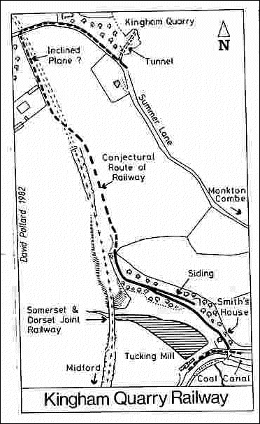
The lower part of the railway is fairly clearly defined in places from Smith's house (ST 765 615) to just north of Tucking Mill viaduct (ST 764 617) a distance of about 350 Yards, rising at a gradient of near 1:10. This length appears to have been of single track and not rope worked. Descending wagons were probably braked with sprags inserted between the spokes of the wheels. A few single-hole stone sleeper blocks can still be seen. These, together with a rail fragment and some nails show that plate rails were used. A small quarry above the railway was linked to it by a short siding. It’s possible that there were horse stables here too.
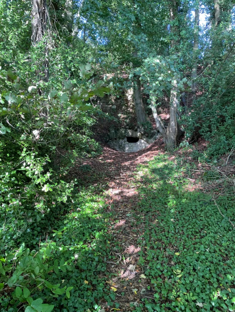
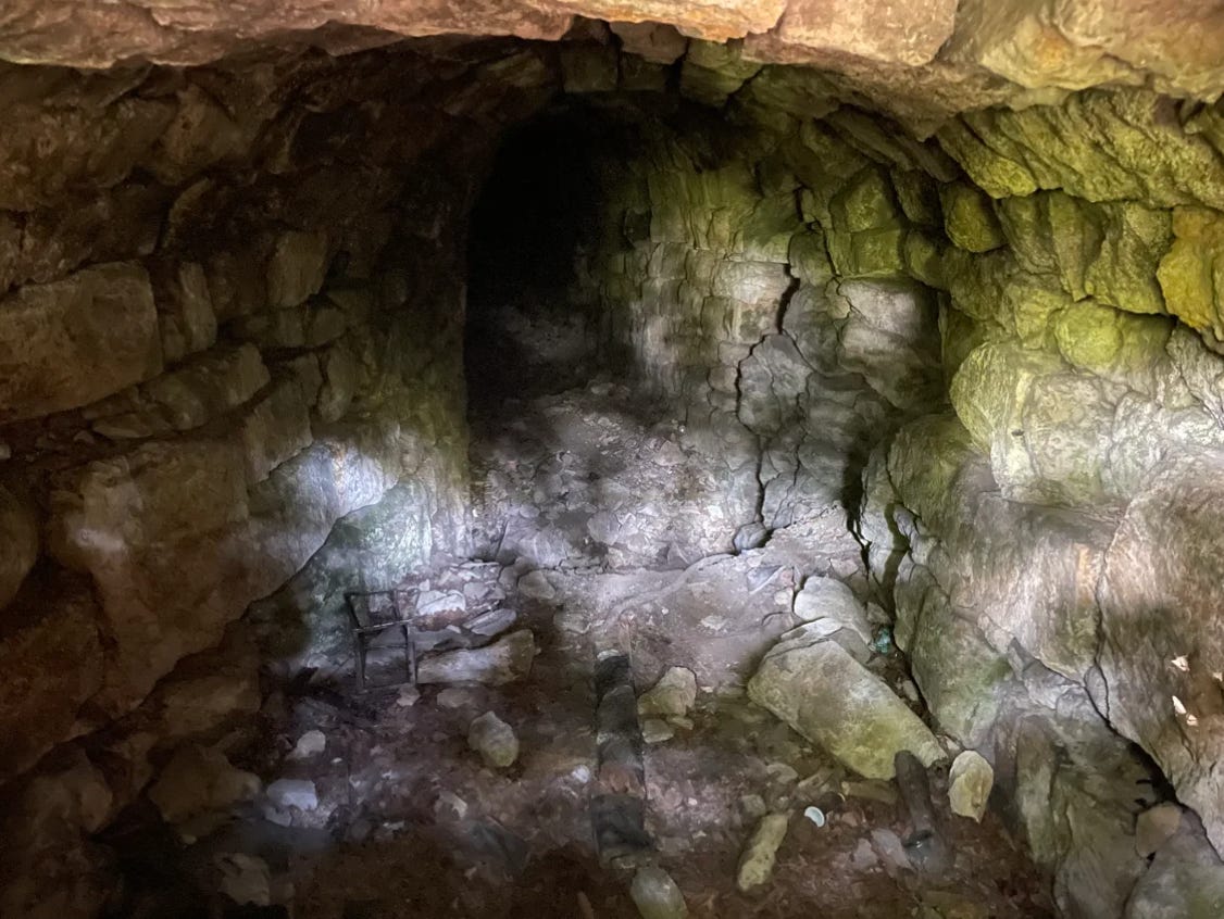
Beyond the viaduct there is no definite trace of the railway, but it is likely that the present footpath to Summer Lane follows it very closely. Kingham is a small open quarry by Summer Lane (ST 765 621) which has been backfilled with quarry waste over a tunnel of railway proportions. This must be the 'quarry arch’.Smith’s saw opened on 6 November 1812. The tunnel is made of unmortared scappled freestone blocks, and has fallen in about 30 ft from the entrance. It undoubtedly led to underground workings. Recent excavations showed that it once extended closer to the Lane. See picture below.
Besides stone, the railway may have carried sand used for bread-oven floors, which Smith obtained from small tunnels driven into the hillside behind his house. The partly collapsed entrance to one of these survives by the railway close to Smith's house. Today, William Smith has a crater on Mars named after him. A William Smith facsimile was created at the Natural History Museum in 2005, where he sits alongside reputable figures like Carl Linnaeus, Mary Anning and Dorothea Bate. Smith’s work also provided an important foundation for the discoveries of Charles Darwin.
New Google Mapsfeature (Old) - and New
See:Also:https://www.youtube.com/watch?app=desktop&v=j2M_TXx0Jo0